Saturday, 19 September 2015

Day 20 - September 13th 2015 - St Ives to Porthtowan

Excitedly I returned to Cornwall, five months having passed since my nineteenth day of walking ended at Easter. In anticipation of tough walking at times this week I'd been running regularly and taking walks on the steep coastal hills east of Sidmouth to keep in shape in the meantime. Lea dropped me back at Porthmeor Beach St Ives where I stopped in April, pleasant sunshine defying the weather forecast which had led us to expect a wet day.

Almost immediately I passed the first landmark of the day, the Tate St Ives. The town is famed for it's exceptional light, which has attracted a large community of artists. To my untrained eye the light looked great, but I couldn't really see how it was that much better than the light elsewhere on the Cornish coast.

Around St Ives the path was busy with strollers and dog walkers out enjoying the Sunday morning sunshine. The walking was easy, I passed the pretty harbour. Porthminster Beach looked very attractive. After some slightly inland walking around Porthminster Point, mainly close to the railway line, I emerged above Carbis Bay, another very pleasant beach. There was an unusual diversion here. The path went through the well-kept grounds of The Carbis Hotel, even passing right next to the swimming pool where holiday makers were sunbathing and swimming.

When I rounded the headland at Carrack Gladden the wide expanse of Porth Kidney Sands opened before me. The tide was low, it was a huge expanse of sand, a glorious sight in the sunshine. The walking was still very easy. After passing a golf course the path was mainly on roads around the Hayle Estuary. This section was quite dull. Hayle itself seemed rather dour. The old swing bridge looked like it hasn't swung in a very long time, and won't be swinging any time soon. Perhaps the most interesting thing I saw in town was a Cornish pasty shop with a long queue out the door. I assumed they must be very tasty. Though I was tempted to try one I didn't want to stop to queue, besides my lunch break was already arranged.

After leaving Hayle the path wound its way through dunes behind Gwithian Beach for at least a couple of miles. This was more like it, the sun was shining, the beach views were lovely and the walking surfaces quite firm underfoot. Attractive slate signs at regular intervals meant the official coast path's winding route was easy to follow through the dunes of Mexico Towans and Upton Towans. After a while I reached the car park next to the Godrevy Café where Lea was waiting and stopped for my lunch break.

From there it was an easy uphill stroll to Godrevy Point. From the cliff-top I enjoyed the view across to Godrevy island and it's lighthouse. There were great views back along Gwithian Beach and Porth Kidney Sands. In the far distance in the clear conditions I could make out a much larger island, I assumed this must be Lundy. Nearby there were quite a few people watching for seals above a cove at Navax Point. One excited man kept saying things to his wife like 'There he is! There! See him?'. If there actually was a seal there it wasn't spotted by anybody else, including his wife or me.

The walking was still quite easy along the cliff-tops of the Carvannel Downs. The views were great. Hells Mouth was a highlight, a spectacular Cove surrounded by high cliffs. Not long after leaving Hell's Mouth that rain promised in the weather forecast finally arrived, only about half a day late. On went my waterproofs. I wasn't complaining, it was 4-00pm by now, I'd been expecting it to be wet all day.

The next town I came to was Portreath. Five years ago during my end-to-end walk I left the coast path here after using it from Harlyn Bay. It was while walking that stretch that I first fell in love with the South West Coast Path, triggering the desire come back and walk it all one day. Despite the rain there were teenagers in wetsuits enjoying the water at Portreath. A group of maybe a dozen boys were larking about with surfboards on the beach, I saw three girls jump into the water from the harbour wall.

Leaving town I made a minor navigational blunder when I somehow missed a diversion sign. I took the path shown on my map, the same route I'd used in 2010, that goes past the white navigational tower. It turned out to be a dead-end where there has been a cliff collapse. I had to return to the road having walked a few hundred unnecessary yards. Maybe it was just as well, I remember the lost section being steep, rugged and dangerous.

The rain intensified as I walked between the cliff-tops and the Portreath MOD site. Perhaps the steepest descent and ascent of the day was at Sally's Bottom which is named after an abandoned mine. Above Sally's Bottom there used to be the Nancekuke Chemical Defence Establishment. An internet search brings up all sorts of interesting claims about the base and what may, or may not, have been dumped in the old mineshafts when it was closed down. For no obvious reason some derelict mine buildings a bit further on were undergoing renovation, an old chimney was covered in scaffolding and there were new concrete repairs on the ruins.

Soon I made my way down to Porthtowan where Lea was waiting as expected. The walking had been quite easy today, the scenery fantastic. Within an hour we were enjoying a delicious meal at our favourite fish 'n chip shop in Falmouth. My legs felt great, to say I was super-happy to be back in Cornwall would be an understatement.


Distance Walked Today 23.88 miles (38.43km)

Walking Time; 7 hours 8 minutes

Average Walking Speed 3.3 mph

Cumulative Distance Walked 452.70 miles (728.55km)

GPS Track; https://runkeeper.com/user/GaryQQQ/activity/655375651

The Tate St Ives where I started walking at Porthmeor Beach

View of Porthminster Beach and St Ives


Part of the unusual path diversion at The Carbis Bay Hotel, the pool was directly
to my right when I took this picture

Porth Kidney Sands opens before me at Carrack Gladden

The pasty shop I saw in Hayle with a queue out the door


Gwithian Beach viewed from the dunes at Mexico Towans, Godrevy Island in the distance

View over Godrevy Island on the approach to Godrevy Point


Hells Mouth, if you can spot him a man in black standing atop the cliff gives a sense of scale

 
Looking back over the cliff-tops already walked above Porth-Cadjack Cove, Carvannel Downs
 
Arriving at Portreath in the rain
 

Colourful scenes greet me despite the dull weather on arrival at Sally's Bottom, steepest descent
and ascent of the day, the land behind the high-security fence belongs to the MOD.


Wednesday, 15 April 2015

Day 19 - April 10th 2015 - Lands End to St Ives


It's Friday now and Lea was back as support car driver. I was expecting a long tough day so we arrived at Lands End early. After taking a rest day on Thursday my legs were feeling fresh, raring to go, the stiffness I'd felt after Tuesday's exertions now gone. I wasn't expecting to see a shop, café or pub next near the path all day so my pack was well stocked with fluids and food making it a bit heavier than usual. The national news was predicting that today would be the warmest of year so far for much of the UK. That seemed unlikely down here, it was overcast, windy and cold. Only 9C when I started walking. The Lands End complex hadn't opened and was still deserted. Very different to Wednesday afternoon when it was buzzing in warm sunshine.

After only a mile of fairly easy cliff-top walking I dropped down to Sennen Cove. It looked pleasant here, but in the grey windswept conditions I don't think I saw it at it's best. There were three hardy surfers bobbing up and down in the sea already, nobody else around. I watched one of the surfers catch a wave just right and ride it expertly to the shore. My camera came out, hoping to snap one of the others do the same. They both kept trying. They both kept failing. I gave up waiting and continued on my way. A short distance on I came to Gwynver Beach. I chose to walk across the sand rather along the official path which is just behind the beach.

Then the going started to get tougher. Gradients got sharper, my clambering skills came into use again on the rockiest sections. I was surprised to see a lady jogging along the path going the other way. Entering a grassy cliff-top field I saw a low circular wall. At first I thought it might be the remains of a roundhouse. However when I saw another two similar walls up close a bit further on I realised they were barriers around open mine shafts, presumably to stop people and animals falling in. By the time I reached Cot Valley there were shafts and the remains of old mine works everywhere. This area must have looked so different in its hey day.

After climbing out of Cot Valley the headland of Cape Cornwall came into view. Before I got there I passed signs just after Gribba Point politely asking walkers to move through quickly where there were nesting Choughs. I did just that as requested but didn't see the rare birds. On the other side of this zone stood a man dressed in green holding binoculars. I assumed he must be a volunteer there protecting the birds. At Cape Cornwall I climbed to the top and stood next to the chimney taking in the views. It feels like a more significant prominence than Lands End, very exposed, no hiding place from the wind. It's easy to see why people thought this was the furthest point west before the era of modern mapping.

I pressed on, determined to cover more than half the days mileage before stopping for lunch. The going was hilly, there was evidence of mining everywhere. At Bottallack there were some fantastic ruins, including two engine houses near the bottom of a cliff. I learned later the shafts here stretched out hundreds of metres under the sea, the miners could hear boulders moving about on the sea bed above them. Brave men. A little further on I passed through Levant mine, it was partly restored and groups of paying tourists were being shown around. The mines kept coming one after another for a while. You couldn't tell where one stopped and the next one started. Below an abandoned arsenic works I saw vivid green and white colours on the cliff face. I wondered if they were real, or if pots of paint had been thrown down to make it all look more realistic to the visitors.

A mile further on I passed Pendeen Lighthouse, then above the beach at Portheras Cove. You are advised not to walk on this beach in bare feet because of sharp metal pieces left behind after a wreck was blown-up in 1963. There was just one person down there today, a lady walking backwards and forwards for no obvious reason, though she did have shoes on. After Portheras the path wound it's way on, dodging boulders strewn along the tops of shallow cliffs. I didn't see any other walkers in this remote area.

As I descended into the valley at Porthmonia Cove I admired Bosigran Cliff in front of me. I couldn't see anybody at first, but I could hear voices. Then I noticed two climbers in a precarious position near the top of the cliff, hundreds of feet above the sea. I watched for a short while, then ate my packed lunch on an old stone bench in this wonderful location.

After lunch the only lived-in building I saw near path the between Bosigran and St Ives was a cottage in a wonderful spot overlooking Treen Cove. The rest of the way it was barren and rugged. There were a couple of delightful stone footbridges to cross. More boulders to clamber over. It got surprisingly boggy in places. I often found myself on stepping stones carefully making my way across marshy ground, trying hard not to fall in. The hills kept coming, though none of them seemed particularly severe. It stayed heavily overcast, cool and windy all day. Not that I was complaining, all three walking days of this visit had been dry, two of them sunny. When I started to see local dog walkers I knew St Ives wouldn't be far. At Clodgy Point the town suddenly came into view. It was an easy though somewhat muddy final mile from here.

Lea was waiting for me in the car park at Porthmeor Beach at the end of a tough yet exhilarating day of walking. My legs felt great and wanted to continue walking the next day, however it was time to return home. I'd had another brilliant three days on the beautiful South West Coast Path and cannot wait to return later in the year. I'll return to St Ives in mid-September when this amazing journey will resume.

Thanks for reading, Gary :)

Distance Walked Today 23.41 miles (37.67km)

Walking Time; 8 hours 38 minutes

Average Walking Speed 2.7 mph

Cumulative Distance Walked 428.82 miles (690.12km)

GPS Track; click here

An early start and I have the Lands End complex to myself


Sennen Cove on a grey morning


Approaching Cape Cornwall


Old mine buildings in a dramatic position at Bottallack


Levant Mine ruins, notice the colours on the cliff
Bosigran Cliff, if you look very closely or zoom-in you'll spot the two climbers just left of centre,
one is wearing a red helmet, the other is stood next to him on a ledge

Stone footbridge near Zennor

Rugged, isolated coastline between Zennor and St Ives

One of many places where the only way to progress is to clamber across huge boulders
St Ives comes into view at Clodgy Point

Monday, 13 April 2015

Day 18 - April 8th 2015 - Marazion to Lands End

My mum Eileen was driver for the day again. When she dropped me back at Marazion I told her I couldn't believe my luck. We were set for another dry, sunny day. Having enjoyed a completely dry week on my last visit to Cornwall in September I felt very fortunate to have booked my return during what would turn out to be the best weather of 2015 so far.

I set-off with great views of St Michael's Mount to my left and over the golden sands of Mounts Bay in front of me. The walking was easy and I made good pace. I shared the path with local dog walkers and joggers. Soon the railway was on my right. I've walked this section from Marazion to Newlyn before, it was Tuesday 5th October 2010, the penultimate day of my solo end-to-end. Back then there was a heliport close to the path into Penzance from where huge helicopters took passengers to and from the Scilly Isles. Now it was gone, replaced by a large supermarket. A wind-sock on the roof the only reminder of the sites former use.

Due to maintenance Penzance Promenade didn't look at it's best today. For its entire length the part nearest the sea was fenced-off because posts and hand-rails were being replaced. I saw a group of boys on their Easter school break enjoying themselves in a skate park. Soon I was in Newlyn passing the fish market then the busy harbour. I saw a group of tired fishermen sitting in the sun outside a café, it looked like they weren't long back in port.

There was yet more easy walking on a cycle-way, that looks like it was probably built on an old railway bed, between Newlyn and Mousehole. There were fine views back across Mounts Bay. I saw the old Penlee Lifeboat Station and a memorial to the eight man crew lost in the awful Penlee Lifeboat Disaster. I'd never been to Mousehole before, it looked marvellous in the late-morning sun, my favourite of the four towns seen so far today. I took a short break and admired the delightful harbour.

The seven miles covered so far had been completely flat, almost too easy. This was about to change. My legs were reminded that coast walking is usually hilly as I climbed a short sharp hill on my way out of Mousehole. Then I emerged on a rugged cliff-side. The path here zig-zagged around picking it's way between massive boulders and over streams, always going up or down, muddy in places. It felt more like an obstacle course than a footpath and progress became much slower. As I clambered my way around barren Kemyel Point Lamorna Cove came into view. With the sun beating down the scene looked more like the Mediterranean than Cornwall. I was surprised to pass two women with young children heading the same way as me in a place that seemed quite dangerous.

The path leaves Lamorna Cove through a car park cut into the cliff-side. At first there appeared to be no way though, I double-checked my map, this couldn't be right. Then I saw a small sign with the usual acorn pointing a way around the side from the car park. This would be the scariest section of the path I saw today. I used hands and legs to haul my way slowly along the cliff while waves crashed on the rocks far below. I saw a memorial plaque fixed onto a large rock above a sheer drop, a fairly large cross dedicated to someone else attached to a boulder nearby. I wondered what had happened to those poor souls and moved on as carefully as possible.

The beach at St Loy was unexpectedly difficult. Storms have covered it with large boulders that have been smoothed by the sea making them look like gigantic pebbles. A very large, strange-looking metal object had also been washed-up. Part of a ship wreck perhaps? Crossing was awkward. There was no obvious route, you just clamber from rock to rock as best you can. I was glad I'd arrived here on a dry day, it looked like it would be slippery when wet. After managing to negotiate my way across this 'beach' I'll never complain about the pebbles at Brighton or Budleigh Salterton again. The coast path was proving to be a real test by now, and I was loving every minute of it.

The going stayed fairly difficult as I pressed on, though in places the path was spectacularly lined by wild flowers. I read later there were abandoned bulb fields here. A flatter grassy section above the Tater-du Lighthouse gave my legs a bit of a rest. Penbearth Cove was a wonderful unspoilt spot. I rested here and admired the man-powered boat winch, wondering if it still works, and how many men are needed to haul in a boat. Three fishermen were working on their craft, local girls were letting their ponies cool down by splashing around in the stream. Heavenly. As I climbed out of the cove I met a small group going the other way who'd stopped on the path above the cove. Their leader, a lady who seemed to know what she was talking about, was trying to point out basking sharks in the clear blue water to the others. I stopped and stared with them for a couple of minutes but didn't see any.

As I approached Porthcurno I saw people who'd bravely climbed up on top of a rough rocky headland. I imagined the views up there must be superb. Later I read this is where the 80 tonne Logan Rock is sited. In 1824 it was dislodged by a group of sailors who were then forced to have it winched back into place their own expense. I could also see the famous Minack open-air theatre on the cliff ahead of me. Porthcurno Beach itself looked fantastic in the sun, clean white sand, the water deep blue. Perhaps unsurprisingly with the theatre and Lands End nearby it was also quite busy. The path passes around the back of the beach. I saw the Grade II listed cable hut being white-washed. Amazingly at least 15 international submarine telecommunication cables come ashore under this fairly small beach, most of them now disused. The museum here immediately became another place on my 'must come back and visit later' list. The path climbed up to the theatre car park via steep steps cut into the cliff. I was glad I was going up, going down must be much scarier. I looked back and admired the wonderful vista. Porthcurno Bay, from Logan Rock around to Minack Point, is one the most beautiful places I've ever walked through. I didn't feel like paying a £3.50 entry fee for a quick look at the theatre from the inside so I pressed on.

After a walk across the top of more cliffs I dropped down into pretty Porthgwarra. I saw a quaint little café where I decided to buy a pasty and take a break. Like at Porthcurno there were lots of tourists here too (after returning home I learned Porthgwarra was busier than usual because it was a filming location for BBC's Poldark, the most popular drama on television at the time I walked this section). Just above Porthgwarra I saw two colourfully painted navigational aids and the prominent NCI lookout station on Gwennap Head. From here I caught my first glimpse of the Lands End complex. It looked deceptively close but was actually an hour and three miles of lumpy walking away. The coast is barren and rocky here, no trees. I saw many casual walkers out enjoying the Spring sunshine. Not many were on the official coast path, most seemed to be sticking to flatter, straighter, easier paths a bit higher up.

Lands End is often criticised for being over-commercialised, but I like the place and was delighted to return. It still retains a magical atmosphere in my opinion. You really do feel like you're at the furthest extremity of this island. Visitors of many nationalities are clearly happy to be here. End-to-end journeys are often starting, or even better finishing in jubilation. The famous Lands End sign-post attracts plenty of fuss. There's also that magnificent view out to the Longships Lighthouse. In my opinion it's easy to ignore the modern attractions and savour this special place.

My mum was waiting for me at the Lands End sign-post as arranged. When she asked how today's walk had gone I didn't even know where to start, I'd had an absolutely brilliant day.

Distance Walked Today 19.74 miles (31.77km)

Walking Time; 6 hours 50 minutes

Average Walking Speed 2.9 mph

Cumulative Distance Walked 405.41 miles (652.44km)

GPS Track; http://runkeeper.com/user/GaryQQQ/activity/544014669

A pleasant stroll around sunny Mounts Bay in the sunshine to start the day

Mousehole

A rugged section at Kemyel Point approaching Lamorna Cove, soon I'll be on the
even tougher cliff-side section on the other side of the cove

Flowers line the path

St Loy beach covered by huge boulders and a large rusting metal object, two walkers
coming the other way give you a sense of scale


The path winds its way towards Penbearth

Unspoilt Penbearth Cove and the man-powered boat winch


No, this isn't the Mediterranean, it's Porthcurno Cove and Logan's Rock Headland

The café where I bought a pasty at Porthgwarra Cove

Rugged coastline and the Longships Lighthouse on the approach to Lands End


Saturday, 11 April 2015

Day 17 - April 7th 2015 - Lizard Point to Marazion

 
It's Easter weekend 2015, I've returned to Cornwall excited to combine a family holiday with the continuation of this coast path adventure. With Lea still suffering the effects of a broken foot my support crew today were my Mum Eileen and daughter Megan.

After a long drive from our accommodation near Newquay we arrived at Lizard Point. I was happy there was no fog this time, at last I could get a decent look at this unique corner of Britain. Where I'd switched-off GPS tracking next to the lighthouse in September my journey resumed. The three of us walked the short distance down to the most southerly point of the British mainland together. We were the only people there, I've no idea why so few people visit this geographical extremity compared to Lands End. When stood here you're further South than Lille, much of Northern France and almost all of Belgium. After savouring the moment and taking pictures they wished me luck and the proper walking began. Almost immediately I passed above the old abandoned lifeboat station which replaced by the modern one I'd seen on Day 16, then set off along the rugged cliff-tops. There was a biting easterly wind behind me, it was quite hazy, but with only a couple of miles covered I could already pick-out St Michaels Mount in the far distance, this marking my intended destination for the day.

At Kynance Cove the tide was just about low enough to let me drop down and walk across the top of the cove. I'd never seen anything like the striking red serpentine cliff face and pebbles here. A lady wiping tables at the café would be the only other person I'd see in my first 90 minutes of walking in this isolated area. The climb up the other side was the steepest so far on a day that wouldn't turn out to be too tough on the legs. I was rewarded with great views over Asparagus Island, where rare wild asparagus grows, and Gull Island. This section of the path felt quite remote and little-used, signs and waymarks were infrequent. The wind was easing now and it was turning into a fine sunny day.

With around 7 miles covered I passed around Mullion Harbour, then Mullion Cove. The cove was overlooked by an impressive looking cliff-top hotel and not much else. It was a pleasant spot, free of tourist crowds at this time of year. Approaching pretty Poldu Cove I saw the wireless station from where Marconi made the first transatlantic radio message in 1901. The museum here became the latest of many places I've seen on the coast path that I'd like to go back and visit one day. Soon after leaving Poldu I noticed a black bird on a cliff-top bush not far from the path. I was excited it may be a rare Cornish Chough and took a couple of snaps. However after looking at my pictures later I've realised it was just a common blackbird. Oh well. At least I would get to see an actual lizard on the path later in the day.

There was an attractive beach at Church Cove. While being fairly quiet considering the Spring sunshine and school holidays it also had the most visitors I'd seen in any one place so far. It seemed amazing to me that the church next to the beach here has never been overwhelmed by storms or shifting stands. There can't be many prettier places to find a church anywhere in this country.

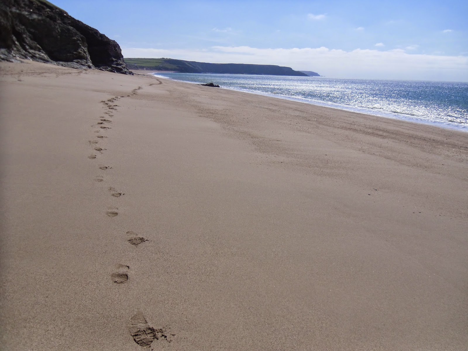
After some more cliff-top walking I arrived at the eastern end of Porthleven Sands. The official path is above the beach, but with the tide receding I preferred to indulge myself in a spot of beach walking. From Gunwalloe to The Loe the beach was almost completely empty. Neither the fine shingle or sand sections were particularly easy to walk on, but it well worth the effort to spend a mile enjoying the geology to my right while waves were breaking to my left. There were quite a few people on Loe Bar, a very wide, tall and apparently storm-proof sand bar which separates the sea from a big fresh water lake. Once in Porthleven itself I took my lunch-break on a bench overlooking the harbour. By now St Michael's Mount was no longer in my line of sight, hidden behind the headland at Cudden Point

Leaving Porthleven I could see the ruins of Wheal Trewavas perched precariously on the side of a cliff a couple of miles ahead (wheal is the Cornish word for mine). I expected the path to pass safely higher up, but I was delighted on arrival to find a short spur passed right through the mines. This was a dramatic spot, the history of places like this fascinate me, I stopped and took many pictures. A little further on the engine house of Wheal Prosper was much more accessible being right next to a small car park. The beach at Rinsey Cove was below. By luck my visit was perfectly timed to admire something I'd never seen before, beach art in the form of patterns in the sand created by Chris Howarth, aka 'One Man and His Rake'. The tide had turned and waves were just starting to erase his impressive work.

Shortly after meeting the aforementioned lizard scurrying along the path Praa Sands would be the next pleasant beach I encountered. Many families were here enjoying what had turned out to be a fine, warm sunny afternoon. Soon after the less accessible Kenneggy Sand was completely empty. As expected St. Michaels Mount came into view again as I rounded Cudden Point, now quite close, as always a spectacular, unmistakeable landmark. The approach to Marazion was easy, passing along the sea side of some farmland, a short beach section, finally finishing on roads. When I arrived Mum and Megan were waiting at our pre-arranged meeting point, a spot where you have the best view of the historic island and the small boats going to and fro.

As we drove back to base I reflected on a truly wonderful day of walking. I was very happy to be back on the wonderful South West Coast Path.


Distance Walked Today 25.39 miles (40.86km)

Walking Time; 7 hours 55 minutes

Average Walking Speed 3.3 mph

Cumulative Distance Walked 385.67 miles (620.68km)

GPS Track; http://runkeeper.com/user/GaryQQQ/activity/543458622

 
Despite a bitter wind my daughter Megan and mum Eileen manage a smile at Lizard Point,
the southern-most point of Great Britain

Serpentine cliff face and pebbles at Kynance Cove
Asparagus Island (nearest) and Gull Island viewed from the cliff top above Kynance Cove
 
Church Cove, the church is to the top right of the picture


My footprints on Porthleven Sands


The ruins of Wheal Trewavas
Beach art by 'One Man and His Rake' at Rinsey Cove, the children standing in the pattern give a sense of size


Arriving at Praa Sands and the lizard I saw here


The days walking ended with this magnificent view of St Michael's Mount


Thursday, 2 October 2014

Day 16 - September 19th 2014 - Helford to Lizard Point

Today would be the last I'd spend on the South West Coast Path in 2014. I was excited at the prospect of making my way around the Lizard Peninsula as far as Lizard Point. This would require around 23 miles of walking, well within my daily range. However there was a bad start to the day. A frustrating traffic delay caused by roadworks meant the journey from our hotel to Helford took far longer than expected. Thick fog didn't help either. When we eventually arrived I made my way down to the jetty where the ferry lands at Helford Point. I wasn't ready to start walking until 10-45am, more than an hour later than I'd hoped.

There was little point actually crossing the River Helford on the ferry. It would make no difference to the distance walked, but would add significantly to the amount of driving required. To call the ferry from Helford Point I noticed you need to open up an indicator board. I'd seen the same system working very well back at the River Yealm earlier this week. However what would happen today? The fog was so thick you couldn't see across the river. The ferry operator, who's based on the opposite bank at Helford Passage wouldn't be able to see the sign that alerts him to passengers awaiting collection.

After passing through Helford Village I made my way along the southern bank of the Helford River through woods. For the first time this week it was slippery underfoot. There hadn't been any rain, but moisture was dripping off the trees. It was still and eerie, I could see almost nothing beyond the trees in the dense fog. All I could hear was the river gently lapping against it's banks and a distant fog horn. I only knew I'd reached the sea when the sound of the waves changed. It didn't take long to work out the fog horn was sounding exactly once per minute for four seconds. I amused myself by imitating the horn, using my watch to join-in with perfect timing. Fortunately the path was quiet, nobody caught me.

For the sake of completeness I did the loop around Dennis Head during the third mile. It turned out to be pointless, all I saw was gorse and fog. I could neither hear nor see any sign of the sea while up there.

It was low water when I arrived at nearby Gillan Harbour. I'd been hoping to cross Gillan Creek on the stepping stones to save two or three miles of walking, but they were closed due a collapsed riverbank. I had no choice but to make the trip around the creek on quiet country lanes, some of which had steep gradients. In this area the coast path seemed little used, there weren't many signs and it was hard to follow. Nothing seemed to be going my way so far today, I was starting to doubt I'd make it to Lizard Point after all.

At Nare Head I passed another NCI lookout, the latest of several I've seen this week. Two men were on duty. I wondered what they do when visibility is so bad you can barely even see the shore. I pressed on to Porthallow where Lea was waiting with lunch. The town looked somewhat grey and drab in this weather. I didn't want to hang around for too long due to pressure of time after the delayed start, but I was delighted to see the South West Coast Path half-way point marker on the beach here. My journey had been absolutely wonderful so far, I couldn't wait to get stuck into the second half.

There was more road walking to do before I rejoined the coast at Porthoustock. Then the path goes between the sea and the abandoned Dean Quarry. It was spooky yet fascinating walking through here in the fog. The rocky terrain of Lowland Point was next. This bleak area reminded me of Portland. I pressed on at a good pace to Coverack where Lea was waiting and took another short break. Lizard Point was now almost exactly ten miles away. I calculated there was just about enough time left in the day to make it. I was feeling strong and determined, keen to get on with the task in hand.

It turned out to be a fairly testing last ten miles. The hard work started immediately after Coverack at Chynhalls Cliffs. A sign here offered an easier option to the official coast path which was described as 'very steep and rocky in parts'. Despite being somewhat hurried there's no way I'd be tempted to skip a challenging section, I always find them highly enjoyable. Without hesitation I chose the difficult path and headed out towards Chynhalls Point.

The sign wasn't exaggerating, this section was right up there with the toughest of the week. The next seven miles delivered the promised steep and rocky surfaces in abundance. There were many sharp ascents and descents, the path zig-zaging its way through this remote rugged section of coast. Often I was clambering over boulders and other tricky obstacles using both hands and feet. There was nobody else around, no roads or or buildings to be seen, no mobile signal. Just me against the coast path. I kept my focus on making it to Lizard Point, determined to conquer this difficult section at a reasonable pace. The poor visibility probably did me a favour, for once I didn't have the usual urge to make frequent stops to take photographs. I had the impression this section would be spectacular on a clear day. At Downas Cove a footbridge had flipped over. I wondered if the damage had occured in last winters storms, and how they even got a footbridge to such in inaccessible spot in the first place.

As I approached Kennack Sands I saw another human being for the first time in five miles, a solo female walker heading east. Apart from one dog walker on the first beach the Sands themselves were deserted. A long section of seawall at the second beach had been smashed to pieces by winter storms, it didn't look like repairs would be happening any time soon. The ruins in Poltesco Valley looked interesting, but I didn't have time to explore and pressed on. Soon I was passing through Cadgwith. By now I could hear another fog-horn in the distance, it seemed to be growing slightly closer. I wondered if  the sound was coming from Lizard Point, still around four miles of walking further on.

Despite the fog I could see enough to tell that The Devils Frying Pan, a 100m deep hole and natural arch, was a wonderful natural spectacle. The sides were much steeper than I expected, the path on the edge felt dangerous. Waves were violently crashing around inside, the name seemed very apt. I pressed on. Suddenly The Lizard Lifeboat Station and its remarkable funicular railway emerged from the gloom. This was another place where I'd have loved to spend more time, but the clock was ticking on my walking week.

The foghorn was getting louder and closer, this one sounding at 30 second intervals. It was at a noticeably higher pitch than the one I'd heard earlier and was echoing off nearby headlands. I wondered if different foghorns play different tones to donate their location. By now I was certain it must coming from Lizard Point. The next landmark of interest I passed was a Marconi radio station. When I passed in front of the Housel Bay Hotel I knew there wasn't far to go. After a last steep descent and ascent thrown in for good measure The Lizard Lighthouse and its foghorns suddenly emerged from the gloom. Hooray, I'd made it. The time was just past 7-00pm, daylight was starting to fade.

At first there was nobody else down on Lizard Point so late in day in fog, I was the furthest south of the 61 million or so people on mainland Great Britain. Well, I was until an excited young family also arrived. I stopped for a few minutes and savoured the moment. It felt great having this geographical landmark to myself briefly, there was also joy at having completing such a wonderful six days of walking upon my arrival.

Lea was waiting patiently in the car park at Lizard Point, all the while having to endure the loud foghorn, still sounding every thirty seconds. She'd done a brilliant job this week as my support driver. After I'd changed out of my walking gear we celebrated a great week with a meal in The Top House Inn. A three hour drive back home in the fog and dark followed.

That's my lot for 2014. I cannot wait to return to Lizard Point and resume this amazing adventure. I expect to be back on the amazing South West Coast Path in Easter 2015.

Thanks for reading.

Gary.

Distance Walked Today 23.55 miles (37.90km)

Walking Time; 7 hours 39 minutes

Average Walking Speed 3.1 mph

Cumulative Distance Walked 360.28 miles (579.81km)

GPS Track; https://www.strava.com/activities/528241644


The ferry landing stage at Helford Point, Helford Passage on the opposite bank is obscured by fog

The South West Coast Path half-way marker at Porthallow Cove

A warning sign at Chynalls Cliff


The path where it goes around Chynalls Point

Downas Cove and the displaced footbridge


Kennack Sands and the smashed seawall
The Lizard Lifeboat Sation, the funicular railway takes crews to the boathouse
which is much lower down

The lighthouse and foghorn salute my arrival at Lizard Point.

Tuesday, 30 September 2014

Day 15 - September 18th 2014 - Portloe to Helford Passage


After four days of fairly high mileage I was pleased to find that my legs were still feeling fresh when I woke this morning. All the effort I'd put into keeping fit through the summer seemed to be bearing fruit. In planning I'd penciled in Falmouth the my most likely target for the current six day stint of walking. However I'd covered more miles than expected in the fine weather and was set to pass through Falmouth mid-way through today, only the fifth of those six days.

Lea dropped me back to the car park where I'd stopped at Portloe yesterday. After making the climb out of town I continued along the clifftops. My camera was playing up, the LCD screen had gone bright white for some reason. I didn't know if the pictures would come out so I switched to taking them on my smartphone instead.

With only two miles covered I got the day's navigational blunder out of the way. Just after Parc Caragloose Cove the path split into two where it entered a field, each way equally worn, no sign directing walkers. I decided to take the left fork, this being the one keeps closest to the coast. After crossing a stile this path went into fairly dense gorse. It didn't seem that well trodden. I already knew I'd made the wrong choice but decided to carry on anyway in the hope it would rejoin the main path a bit further on. Most people who go this way must have turned-back earlier than me because it became increasingly overgrown and harder to follow. I was on the side of a hill that was getting steeper, waves crashing over rocks below me, it began to feel quite dangerous. Where I'd have needed rock climbing gear to go on any further I admitted defeat and gave up, re-tracing my steps to the field with my tail between my legs. A little time had been wasted, but I laughed-off my unintended detour, these mini-adventures are all part of the fun.

Now back on the path proper I pressed on towards Nare Head. I saw quite a lot of Japanese Knotwood in this area. As I headed south this invasive weed seemed to be becoming an increasingly common sight. In a few places attempts were being made to control it, but the weed was still so widepsread this looked like a losing battle to me. I also noticed a mysterious bunker in a field near the cliff. Freshly painted green vents suggesting some sort of underground structure that's still in use. It's always a great moment when you turn the corner on a headland and the next bay opens out in front of you. This happened at Nare Head when I found myself looking through the haze across Gerrans Bay and the next seven miles or so of walking, bring it on!

The path was very quiet this morning. When I'd almost reached Carne Beach a couple heading east became the first people I'd seen since leaving Portloe an hour and a half earlier. I was able to walk along the sand at Carne Beach, a real treat after pounding hard surfaces all week thanks to the on-going long dry spell. I wasn't complaining, a rock-hard path is a price worth paying for fine weather and a total absence of mud. Easy cliff-top walking with pleasant views followed as far as Porthcurnick Beach and nearby Portscatbo where I met Lea and stopped for lunch.

The path was very easy again heading west out of Portscatbo. I saw a recreational runner coming the other way, always a sign there's nothing too bad ahead. There were a few people on Towan Beach. The less accesible Porthbeor Beach was completely empty. Shortly before rounding St. Anthonys Head I caught my first glimpse of Falmouth. In the hazy, humid conditions it was no more than a light grey silhouette. After passing war defences and the lighthouse I emerged in a place called Place. Place House looked wonderful, in a great spot overlooking the river and St.Mawes. Though it was disappointing to see the graveyard of the nearby 13th century church badly overgrown.

Falmouth was now two ferry trips away, there would be no walking for a little while. I found the small jetty at Place easily enough and was delivered to St.Mawes promptly on the half-hourly service. It seemed to be doing good business today. A much bigger ferry with fewer passengers took me over to Falmouth. I was only in St.Mawes for a few minutes though I had good views of the town from the second ferry. By far the biggest vessel in Falmouth today was RFA Mounts Bay, a huge Royal Fleet Auxiliary landing ship.

Unbeknown to us in advance it turned out the St.Mawes ferry alternates between two landing points in Falmouth. We lost the coin-flip; Lea was waiting at one, I arrived at the other. We decided to walk towards each other and meet in the middle. The town was busy, and easily the biggest I'd seen since Plymouth. I took a short break and we finalised plans for the afternoon.

Leaving Falmouth I had a good view of the docks from up above. Among the works I saw the Pendennis super-yacht builders, and a huge dry dock that was empty today. After rounding Pendennis Point I walked along a long peaceful esplanade. Some people were out for an afternoon stroll, others were relaxing on one of the dozens of benches facing out to sea. As always each bench dedicated to some coast-loving soul who's no longer with us. I was making good progress, crossing the Fal hadn't taken as long as I'd expected. By now the decision had been made to press on as far as Helford Passage rather than stop at Maenporth, the other shorter option. This would hopefully set me up to make it to Lizard Point tomorrow. For a short time the sun burnt through the haze while I passed Gyllyngvase Beach, the only time I saw shadows all day.

At Maenporth I met Lea again and took my final short break of the day. She then drove on ahead to Helford Passage while I set about covering the final four miles. The path stayed easy, I was still going well, those last few miles went quickly. Durgan was a wonderful place to walk through, picturesque and unspoilt, it would make a great period film-set. I was disappointed to discover later that nearly all the properties there are second homes or holiday lets. Near Durgan I saw huge pines overlooking the River Helford, the biggest I've ever seen in this country.

On arrival at Helford Passage I walked as far as the ferry crossing point. I'd arrived an hour and a half after it closed, but that was fine, I wouldn't be needing it today. Lea was waiting for me in The Ferryboat Inn just opposite. We enjoyed a delicious meal while there, our best in Cornwall so far. Service was excellent and prices reasonable, highly recommended. I reflected on how well these five days had gone and wondered if my luck could possibly last through the sixth day too.

Distance Walked Today 23.86 miles (38.40km)

Walking Time; 7 hours 41 minutes

Average Walking Speed 3.1 mph

Cumulative Distance Walked 336.73 miles (541.91km)

GPS Track; http://runkeeper.com/user/GaryQQQ/activity/437258644


This picture was taken when I strayed onto the wrong path at Parc Caragloose Rock,
that's Gull Rock in the distance.


My first view of hazy Gerrans Bay as I round Nare Head
Carne Beach, I enjoyed walking on the sand here

 
Porthcurnick Beach, Portscatbo in the distance


Place House


Falmouth emerges from the haze as I approach on the St.Mawes Ferry

Gyllyngvase Beach, the sun briefly burnt through the haze while I was here

The scene on my arrival at Helford Passage