Wednesday 15 April 2015

Day 19 - April 10th 2015 - Lands End to St Ives


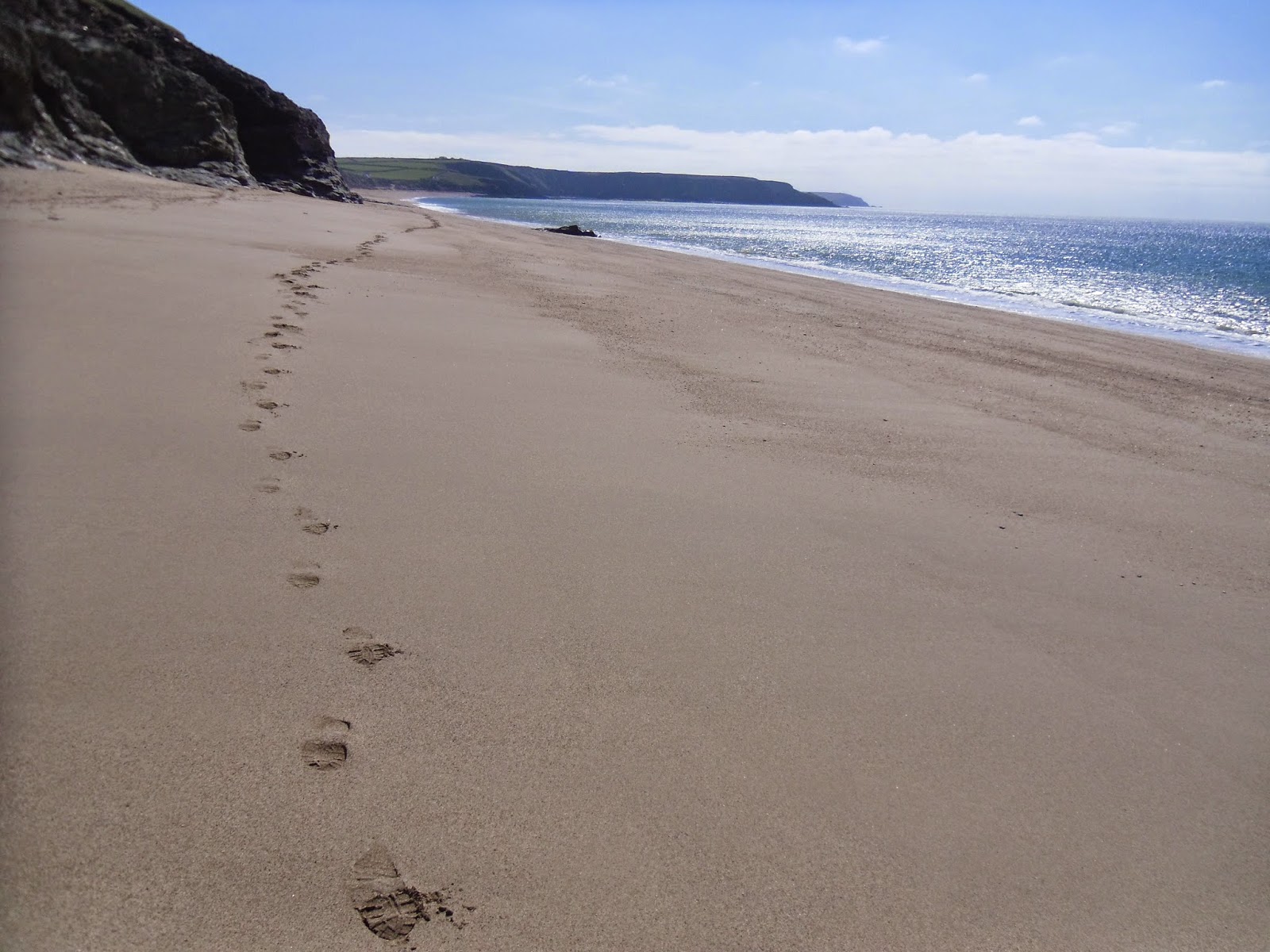
It's Friday now and Lea was back as support car driver. I was expecting a long tough day so we arrived at Lands End early. After taking a rest day on Thursday my legs were feeling fresh, raring to go, the stiffness I'd felt after Tuesday's exertions now gone. I wasn't expecting to see a shop, café or pub next near the path all day so my pack was well stocked with fluids and food making it a bit heavier than usual. The national news was predicting that today would be the warmest of year so far for much of the UK. That seemed unlikely down here, it was overcast, windy and cold. Only 9C when I started walking. The Lands End complex hadn't opened and was still deserted. Very different to Wednesday afternoon when it was buzzing in warm sunshine.

After only a mile of fairly easy cliff-top walking I dropped down to Sennen Cove. It looked pleasant here, but in the grey windswept conditions I don't think I saw it at it's best. There were three hardy surfers bobbing up and down in the sea already, nobody else around. I watched one of the surfers catch a wave just right and ride it expertly to the shore. My camera came out, hoping to snap one of the others do the same. They both kept trying. They both kept failing. I gave up waiting and continued on my way. A short distance on I came to Gwynver Beach. I chose to walk across the sand rather along the official path which is just behind the beach.

Then the going started to get tougher. Gradients got sharper, my clambering skills came into use again on the rockiest sections. I was surprised to see a lady jogging along the path going the other way. Entering a grassy cliff-top field I saw a low circular wall. At first I thought it might be the remains of a roundhouse. However when I saw another two similar walls up close a bit further on I realised they were barriers around open mine shafts, presumably to stop people and animals falling in. By the time I reached Cot Valley there were shafts and the remains of old mine works everywhere. This area must have looked so different in its hey day.

After climbing out of Cot Valley the headland of Cape Cornwall came into view. Before I got there I passed signs just after Gribba Point politely asking walkers to move through quickly where there were nesting Choughs. I did just that as requested but didn't see the rare birds. On the other side of this zone stood a man dressed in green holding binoculars. I assumed he must be a volunteer there protecting the birds. At Cape Cornwall I climbed to the top and stood next to the chimney taking in the views. It feels like a more significant prominence than Lands End, very exposed, no hiding place from the wind. It's easy to see why people thought this was the furthest point west before the era of modern mapping.

I pressed on, determined to cover more than half the days mileage before stopping for lunch. The going was hilly, there was evidence of mining everywhere. At Bottallack there were some fantastic ruins, including two engine houses near the bottom of a cliff. I learned later the shafts here stretched out hundreds of metres under the sea, the miners could hear boulders moving about on the sea bed above them. Brave men. A little further on I passed through Levant mine, it was partly restored and groups of paying tourists were being shown around. The mines kept coming one after another for a while. You couldn't tell where one stopped and the next one started. Below an abandoned arsenic works I saw vivid green and white colours on the cliff face. I wondered if they were real, or if pots of paint had been thrown down to make it all look more realistic to the visitors.

A mile further on I passed Pendeen Lighthouse, then above the beach at Portheras Cove. You are advised not to walk on this beach in bare feet because of sharp metal pieces left behind after a wreck was blown-up in 1963. There was just one person down there today, a lady walking backwards and forwards for no obvious reason, though she did have shoes on. After Portheras the path wound it's way on, dodging boulders strewn along the tops of shallow cliffs. I didn't see any other walkers in this remote area.

As I descended into the valley at Porthmonia Cove I admired Bosigran Cliff in front of me. I couldn't see anybody at first, but I could hear voices. Then I noticed two climbers in a precarious position near the top of the cliff, hundreds of feet above the sea. I watched for a short while, then ate my packed lunch on an old stone bench in this wonderful location.

After lunch the only lived-in building I saw near path the between Bosigran and St Ives was a cottage in a wonderful spot overlooking Treen Cove. The rest of the way it was barren and rugged. There were a couple of delightful stone footbridges to cross. More boulders to clamber over. It got surprisingly boggy in places. I often found myself on stepping stones carefully making my way across marshy ground, trying hard not to fall in. The hills kept coming, though none of them seemed particularly severe. It stayed heavily overcast, cool and windy all day. Not that I was complaining, all three walking days of this visit had been dry, two of them sunny. When I started to see local dog walkers I knew St Ives wouldn't be far. At Clodgy Point the town suddenly came into view. It was an easy though somewhat muddy final mile from here.

Lea was waiting for me in the car park at Porthmeor Beach at the end of a tough yet exhilarating day of walking. My legs felt great and wanted to continue walking the next day, however it was time to return home. I'd had another brilliant three days on the beautiful South West Coast Path and cannot wait to return later in the year. I'll return to St Ives in mid-September when this amazing journey will resume.

Thanks for reading, Gary :)

Distance Walked Today 23.41 miles (37.67km)

Walking Time; 8 hours 38 minutes

Average Walking Speed 2.7 mph

Cumulative Distance Walked 428.82 miles (690.12km)

GPS Track; click here

An early start and I have the Lands End complex to myself


Sennen Cove on a grey morning


Approaching Cape Cornwall


Old mine buildings in a dramatic position at Bottallack


Levant Mine ruins, notice the colours on the cliff
Bosigran Cliff, if you look very closely or zoom-in you'll spot the two climbers just left of centre,
one is wearing a red helmet, the other is stood next to him on a ledge

Stone footbridge near Zennor

Rugged, isolated coastline between Zennor and St Ives

One of many places where the only way to progress is to clamber across huge boulders
St Ives comes into view at Clodgy Point

Monday 13 April 2015

Day 18 - April 8th 2015 - Marazion to Lands End

My mum Eileen was driver for the day again. When she dropped me back at Marazion I told her I couldn't believe my luck. We were set for another dry, sunny day. Having enjoyed a completely dry week on my last visit to Cornwall in September I felt very fortunate to have booked my return during what would turn out to be the best weather of 2015 so far.

I set-off with great views of St Michael's Mount to my left and over the golden sands of Mounts Bay in front of me. The walking was easy and I made good pace. I shared the path with local dog walkers and joggers. Soon the railway was on my right. I've walked this section from Marazion to Newlyn before, it was Tuesday 5th October 2010, the penultimate day of my solo end-to-end. Back then there was a heliport close to the path into Penzance from where huge helicopters took passengers to and from the Scilly Isles. Now it was gone, replaced by a large supermarket. A wind-sock on the roof the only reminder of the sites former use.

Due to maintenance Penzance Promenade didn't look at it's best today. For its entire length the part nearest the sea was fenced-off because posts and hand-rails were being replaced. I saw a group of boys on their Easter school break enjoying themselves in a skate park. Soon I was in Newlyn passing the fish market then the busy harbour. I saw a group of tired fishermen sitting in the sun outside a café, it looked like they weren't long back in port.

There was yet more easy walking on a cycle-way, that looks like it was probably built on an old railway bed, between Newlyn and Mousehole. There were fine views back across Mounts Bay. I saw the old Penlee Lifeboat Station and a memorial to the eight man crew lost in the awful Penlee Lifeboat Disaster. I'd never been to Mousehole before, it looked marvellous in the late-morning sun, my favourite of the four towns seen so far today. I took a short break and admired the delightful harbour.

The seven miles covered so far had been completely flat, almost too easy. This was about to change. My legs were reminded that coast walking is usually hilly as I climbed a short sharp hill on my way out of Mousehole. Then I emerged on a rugged cliff-side. The path here zig-zagged around picking it's way between massive boulders and over streams, always going up or down, muddy in places. It felt more like an obstacle course than a footpath and progress became much slower. As I clambered my way around barren Kemyel Point Lamorna Cove came into view. With the sun beating down the scene looked more like the Mediterranean than Cornwall. I was surprised to pass two women with young children heading the same way as me in a place that seemed quite dangerous.

The path leaves Lamorna Cove through a car park cut into the cliff-side. At first there appeared to be no way though, I double-checked my map, this couldn't be right. Then I saw a small sign with the usual acorn pointing a way around the side from the car park. This would be the scariest section of the path I saw today. I used hands and legs to haul my way slowly along the cliff while waves crashed on the rocks far below. I saw a memorial plaque fixed onto a large rock above a sheer drop, a fairly large cross dedicated to someone else attached to a boulder nearby. I wondered what had happened to those poor souls and moved on as carefully as possible.

The beach at St Loy was unexpectedly difficult. Storms have covered it with large boulders that have been smoothed by the sea making them look like gigantic pebbles. A very large, strange-looking metal object had also been washed-up. Part of a ship wreck perhaps? Crossing was awkward. There was no obvious route, you just clamber from rock to rock as best you can. I was glad I'd arrived here on a dry day, it looked like it would be slippery when wet. After managing to negotiate my way across this 'beach' I'll never complain about the pebbles at Brighton or Budleigh Salterton again. The coast path was proving to be a real test by now, and I was loving every minute of it.

The going stayed fairly difficult as I pressed on, though in places the path was spectacularly lined by wild flowers. I read later there were abandoned bulb fields here. A flatter grassy section above the Tater-du Lighthouse gave my legs a bit of a rest. Penbearth Cove was a wonderful unspoilt spot. I rested here and admired the man-powered boat winch, wondering if it still works, and how many men are needed to haul in a boat. Three fishermen were working on their craft, local girls were letting their ponies cool down by splashing around in the stream. Heavenly. As I climbed out of the cove I met a small group going the other way who'd stopped on the path above the cove. Their leader, a lady who seemed to know what she was talking about, was trying to point out basking sharks in the clear blue water to the others. I stopped and stared with them for a couple of minutes but didn't see any.

As I approached Porthcurno I saw people who'd bravely climbed up on top of a rough rocky headland. I imagined the views up there must be superb. Later I read this is where the 80 tonne Logan Rock is sited. In 1824 it was dislodged by a group of sailors who were then forced to have it winched back into place their own expense. I could also see the famous Minack open-air theatre on the cliff ahead of me. Porthcurno Beach itself looked fantastic in the sun, clean white sand, the water deep blue. Perhaps unsurprisingly with the theatre and Lands End nearby it was also quite busy. The path passes around the back of the beach. I saw the Grade II listed cable hut being white-washed. Amazingly at least 15 international submarine telecommunication cables come ashore under this fairly small beach, most of them now disused. The museum here immediately became another place on my 'must come back and visit later' list. The path climbed up to the theatre car park via steep steps cut into the cliff. I was glad I was going up, going down must be much scarier. I looked back and admired the wonderful vista. Porthcurno Bay, from Logan Rock around to Minack Point, is one the most beautiful places I've ever walked through. I didn't feel like paying a £3.50 entry fee for a quick look at the theatre from the inside so I pressed on.

After a walk across the top of more cliffs I dropped down into pretty Porthgwarra. I saw a quaint little café where I decided to buy a pasty and take a break. Like at Porthcurno there were lots of tourists here too (after returning home I learned Porthgwarra was busier than usual because it was a filming location for BBC's Poldark, the most popular drama on television at the time I walked this section). Just above Porthgwarra I saw two colourfully painted navigational aids and the prominent NCI lookout station on Gwennap Head. From here I caught my first glimpse of the Lands End complex. It looked deceptively close but was actually an hour and three miles of lumpy walking away. The coast is barren and rocky here, no trees. I saw many casual walkers out enjoying the Spring sunshine. Not many were on the official coast path, most seemed to be sticking to flatter, straighter, easier paths a bit higher up.

Lands End is often criticised for being over-commercialised, but I like the place and was delighted to return. It still retains a magical atmosphere in my opinion. You really do feel like you're at the furthest extremity of this island. Visitors of many nationalities are clearly happy to be here. End-to-end journeys are often starting, or even better finishing in jubilation. The famous Lands End sign-post attracts plenty of fuss. There's also that magnificent view out to the Longships Lighthouse. In my opinion it's easy to ignore the modern attractions and savour this special place.

My mum was waiting for me at the Lands End sign-post as arranged. When she asked how today's walk had gone I didn't even know where to start, I'd had an absolutely brilliant day.

Distance Walked Today 19.74 miles (31.77km)

Walking Time; 6 hours 50 minutes

Average Walking Speed 2.9 mph

Cumulative Distance Walked 405.41 miles (652.44km)

GPS Track; http://runkeeper.com/user/GaryQQQ/activity/544014669

A pleasant stroll around sunny Mounts Bay in the sunshine to start the day

Mousehole

A rugged section at Kemyel Point approaching Lamorna Cove, soon I'll be on the
even tougher cliff-side section on the other side of the cove

Flowers line the path

St Loy beach covered by huge boulders and a large rusting metal object, two walkers
coming the other way give you a sense of scale


The path winds its way towards Penbearth

Unspoilt Penbearth Cove and the man-powered boat winch


No, this isn't the Mediterranean, it's Porthcurno Cove and Logan's Rock Headland

The café where I bought a pasty at Porthgwarra Cove

Rugged coastline and the Longships Lighthouse on the approach to Lands End


Saturday 11 April 2015

Day 17 - April 7th 2015 - Lizard Point to Marazion

 
It's Easter weekend 2015, I've returned to Cornwall excited to combine a family holiday with the continuation of this coast path adventure. With Lea still suffering the effects of a broken foot my support crew today were my Mum Eileen and daughter Megan.

After a long drive from our accommodation near Newquay we arrived at Lizard Point. I was happy there was no fog this time, at last I could get a decent look at this unique corner of Britain. Where I'd switched-off GPS tracking next to the lighthouse in September my journey resumed. The three of us walked the short distance down to the most southerly point of the British mainland together. We were the only people there, I've no idea why so few people visit this geographical extremity compared to Lands End. When stood here you're further South than Lille, much of Northern France and almost all of Belgium. After savouring the moment and taking pictures they wished me luck and the proper walking began. Almost immediately I passed above the old abandoned lifeboat station which replaced by the modern one I'd seen on Day 16, then set off along the rugged cliff-tops. There was a biting easterly wind behind me, it was quite hazy, but with only a couple of miles covered I could already pick-out St Michaels Mount in the far distance, this marking my intended destination for the day.

At Kynance Cove the tide was just about low enough to let me drop down and walk across the top of the cove. I'd never seen anything like the striking red serpentine cliff face and pebbles here. A lady wiping tables at the café would be the only other person I'd see in my first 90 minutes of walking in this isolated area. The climb up the other side was the steepest so far on a day that wouldn't turn out to be too tough on the legs. I was rewarded with great views over Asparagus Island, where rare wild asparagus grows, and Gull Island. This section of the path felt quite remote and little-used, signs and waymarks were infrequent. The wind was easing now and it was turning into a fine sunny day.

With around 7 miles covered I passed around Mullion Harbour, then Mullion Cove. The cove was overlooked by an impressive looking cliff-top hotel and not much else. It was a pleasant spot, free of tourist crowds at this time of year. Approaching pretty Poldu Cove I saw the wireless station from where Marconi made the first transatlantic radio message in 1901. The museum here became the latest of many places I've seen on the coast path that I'd like to go back and visit one day. Soon after leaving Poldu I noticed a black bird on a cliff-top bush not far from the path. I was excited it may be a rare Cornish Chough and took a couple of snaps. However after looking at my pictures later I've realised it was just a common blackbird. Oh well. At least I would get to see an actual lizard on the path later in the day.

There was an attractive beach at Church Cove. While being fairly quiet considering the Spring sunshine and school holidays it also had the most visitors I'd seen in any one place so far. It seemed amazing to me that the church next to the beach here has never been overwhelmed by storms or shifting stands. There can't be many prettier places to find a church anywhere in this country.

After some more cliff-top walking I arrived at the eastern end of Porthleven Sands. The official path is above the beach, but with the tide receding I preferred to indulge myself in a spot of beach walking. From Gunwalloe to The Loe the beach was almost completely empty. Neither the fine shingle or sand sections were particularly easy to walk on, but it well worth the effort to spend a mile enjoying the geology to my right while waves were breaking to my left. There were quite a few people on Loe Bar, a very wide, tall and apparently storm-proof sand bar which separates the sea from a big fresh water lake. Once in Porthleven itself I took my lunch-break on a bench overlooking the harbour. By now St Michael's Mount was no longer in my line of sight, hidden behind the headland at Cudden Point

Leaving Porthleven I could see the ruins of Wheal Trewavas perched precariously on the side of a cliff a couple of miles ahead (wheal is the Cornish word for mine). I expected the path to pass safely higher up, but I was delighted on arrival to find a short spur passed right through the mines. This was a dramatic spot, the history of places like this fascinate me, I stopped and took many pictures. A little further on the engine house of Wheal Prosper was much more accessible being right next to a small car park. The beach at Rinsey Cove was below. By luck my visit was perfectly timed to admire something I'd never seen before, beach art in the form of patterns in the sand created by Chris Howarth, aka 'One Man and His Rake'. The tide had turned and waves were just starting to erase his impressive work.

Shortly after meeting the aforementioned lizard scurrying along the path Praa Sands would be the next pleasant beach I encountered. Many families were here enjoying what had turned out to be a fine, warm sunny afternoon. Soon after the less accessible Kenneggy Sand was completely empty. As expected St. Michaels Mount came into view again as I rounded Cudden Point, now quite close, as always a spectacular, unmistakeable landmark. The approach to Marazion was easy, passing along the sea side of some farmland, a short beach section, finally finishing on roads. When I arrived Mum and Megan were waiting at our pre-arranged meeting point, a spot where you have the best view of the historic island and the small boats going to and fro.

As we drove back to base I reflected on a truly wonderful day of walking. I was very happy to be back on the wonderful South West Coast Path.


Distance Walked Today 25.39 miles (40.86km)

Walking Time; 7 hours 55 minutes

Average Walking Speed 3.3 mph

Cumulative Distance Walked 385.67 miles (620.68km)

GPS Track; http://runkeeper.com/user/GaryQQQ/activity/543458622

 
Despite a bitter wind my daughter Megan and mum Eileen manage a smile at Lizard Point,
the southern-most point of Great Britain

Serpentine cliff face and pebbles at Kynance Cove
Asparagus Island (nearest) and Gull Island viewed from the cliff top above Kynance Cove
 
Church Cove, the church is to the top right of the picture


My footprints on Porthleven Sands


The ruins of Wheal Trewavas
Beach art by 'One Man and His Rake' at Rinsey Cove, the children standing in the pattern give a sense of size


Arriving at Praa Sands and the lizard I saw here


The days walking ended with this magnificent view of St Michael's Mount