After clambering up the crumbling sand of a tall dune the path took me to Fishing Cove Field. I didn't see anybody fishing, but the beach here was very popular with dog walkers. I wondered if perhaps it should be renamed Dog Walkers Field. One couple had about 10 excited dogs, all running loose, most of them barking loudly. I'm not sure why they need so many, other owners with only one or two dogs each didn't look too impressed.
It was an easy stroll around to Polzeath which was surprisingly busy. I didn't realise at the time, but I passed the 500 miles walked landmark on this journey as I passed the Tristram Car Park where the path enters town. There were dozens of people in water, most with surf boards, mainly school-age children, though none were managing to ride today's relatively small waves. I saw a coach in the car park from Germany. There was a happy atmosphere about the place, everybody seemed to be having fun. I could see why current UK Prime Minister David Cameron and his family choose to holiday at Polzeath.
The first noticeable climbs of the day came on the approach to Pentire Point, though nothing too strenuous so far. There seemed to be quite a lot of cliff erosion here. When I got to Pentire Point the visibility wasn't at it's best, but there were good views looking three ways, inland up The Camel Estuary towards Padstow and Rock, south looking over the headlands where I'd walked yesterday, and north up the coast where I'd be heading today.
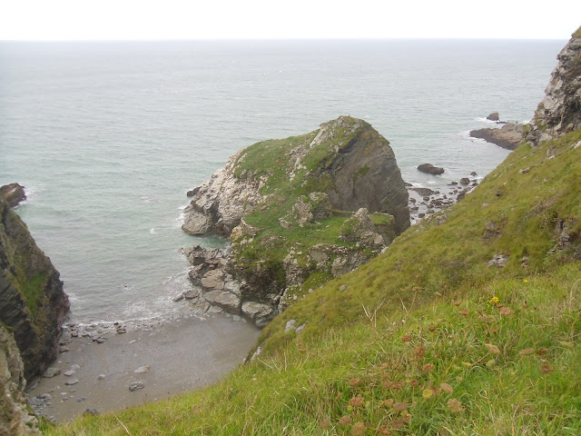
The distinctive headland at The Rumps looked like an attractive little detour, but I decided I didn't really have time and pressed on. Behind Lundy Beach I was thrilled to 'discover' Lundy Hole, a collapsed cave similar to those I'd seen yesterday. This one was much easier to enjoy because it cuts into the side of a very steep hill, giving passing walkers a grandstand view. It was a wonderful place that my pictures do no justice. One of those places you have to see with your own eyes to truly appreciate. Scenic Lundy Beach, Lundy Hole and adjacent Epphaven Cove were easily my favourite place of the day so far.
Approaching Port Quin on windy cliff-tops I saw the first abandoned mine shafts since Newquay, then Doyden Castle. It's not a real castle by any means, more a small folly on top of a hill. Unimpressed I didn't bother climbing the hill where it stands for a closer look. Port Quin itself, a pretty little hamlet at the end of a well sheltered cove, was quaint and unspoilt. A few days before my visit it had been used by the BBC to shoot scenes for a new series of Poldark. I could see why, it doesn't look like it's changed much in a very long time.
After leaving Port Quin the going started to get hilly. The ascents and descents were becoming longer and steeper. For a while I caught occasional glimpses of a person in a bright white jacket ahead of me. When I eventually caught up I saw she was one half of a couple. Both were wearing fashionable sandals, not the usual choice of coast walkers. Even more surprising when I said hello I noticed that the lady in the white jacket was carrying a small dog. They were probably the most eccentric walkers I'd seen so far this week, though to be fair to they'd almost reached Port Isaac after completing a fairly tough stretch of the coast path. The section between Polzeath and Port Isaac was quite popular with walkers, busier than I'd expected.
Port Isaac has gained notoriety as the filming location for the long-running TV comedy series Doc Martin. I've never watched it myself, but it was easy to see why pretty Port Isaac was chosen. Similar to Port Quin but larger, the harbour area is unspoilt, the streets too narrow for modern vehicles, many old buildings and Cornish Charm in abundance. I was reminded of Polperro and Mevagissey. On my way in I'd walked right past the front door of the fictional doctor's house without realising. Lea was waiting in town, we ate lunch overlooking the harbour. It was probably as busy here as Padstow. Clearly Doc Martin brings many tourists this way.
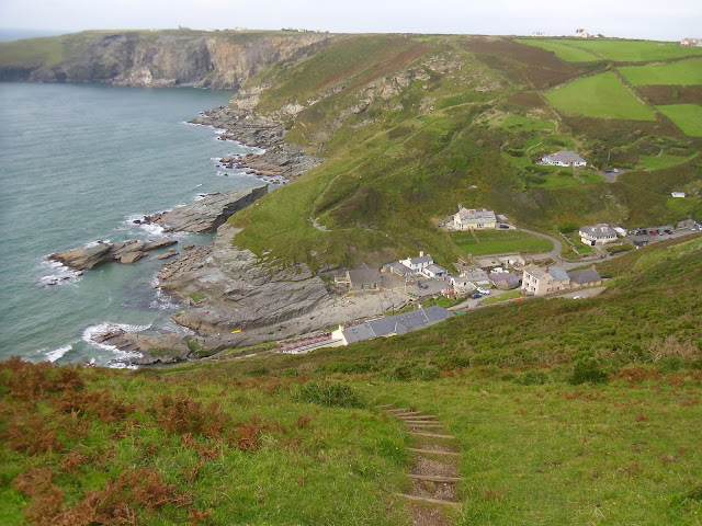
Port Gaverne was a short road walk from Port Isaac, from there I made a fairly steep climb up onto cliff-tops. For the rest of the afternoon the path would be much quieter than it had in the morning, the walking would be much more difficult too. There were a series of eight energy-sapping ascents and descents between Port Gaverne and Tintagel. The height and steepness of each was similar to the hills east of Sidmouth where I'd walked occasionally through the summer to keep in shape. I was now glad I'd put in the practise.
There were no steps cut into the first few steep hills, the surfaces loose and difficult. Going up was often more a case of scrambling on all fours than walking. Going down felt dangerous. When I did eventually find a flight of steps going down they led straight off the edge of a cliff where the path had fallen away. However, as usual the coast path rewarded tough walking with great views. The coast was spectacular along this stretch, the effort as always more than worthwhile.
I wondered why Dannon Chapel was so named when it appeared to be in the middle of nowhere, far from any buildings. I realised why when I spotted the ruins of what looked like a small chapel on a headland. The last of the eight steep descents was my way out of Trebarwith Strand, a picturesque inlet, a lovely spot to visit. The pub here was tempting, there were kids in the water, an RNLI lifeguard keeping watch as usual.
As I got closer to Tintagel I started to see many abandoned slate quarries that had taken massive chunks out of the cliffs. In one of them the miners had left a huge column of rock at least a hundred feet tall. I wondered why, and if it's ever been climbed.
The steep hills turned into easier undulations on the approach to Tintagel Island, which was bathed in late afternoon sunshine. After taking a few pictures of the island and ruins there was one last unexpected steep slog on tarmac up to the village where Lea was waiting. My legs let it be known they didn't like it after a tough day. We went to the nearby King Arthur's pub for a meal. I was hungry and thirsty after another magical day on the wonderful South West Coast Path.
Distance Walked Today 21.60 miles (34.76km)
Walking Time; 7 hours 22 minutes
Average Walking Speed 2.9 mph
Cumulative Distance Walked 518.90 miles (835.09km)
GPS Track; https://runkeeper.com/user/GaryQQQ/activity/657351615
 |
| The ferry to Padstow leaving Rock |
 |
| Despite leaden skies the beach at Polzeath was very popular |
 |
| Lundy Hole |
 | ||
| Lundy Beach and Epphaven Cove, Lundy Hole cuts through the hill just right and above centre
|
 |
| The lady in a white jacket I saw wearing sandals and carrying a dog over steep hills |
 |
| Port Isaac |
 |
| Doc Martin's house. It looks like he's in! |
 |
| The ruins at isolated Dannon Chapel |
 |
| Looking down over Trebarwith Strand as I contemplate the last steep decent and ascent of a tough afternoon |
 |
| The huge column left in an old slate quarry near Tintagel |
 |
| Tintagel Island bathed in late afternoon sunshine |

No comments:
Post a Comment